GETTING AROUND
ORIENTATION
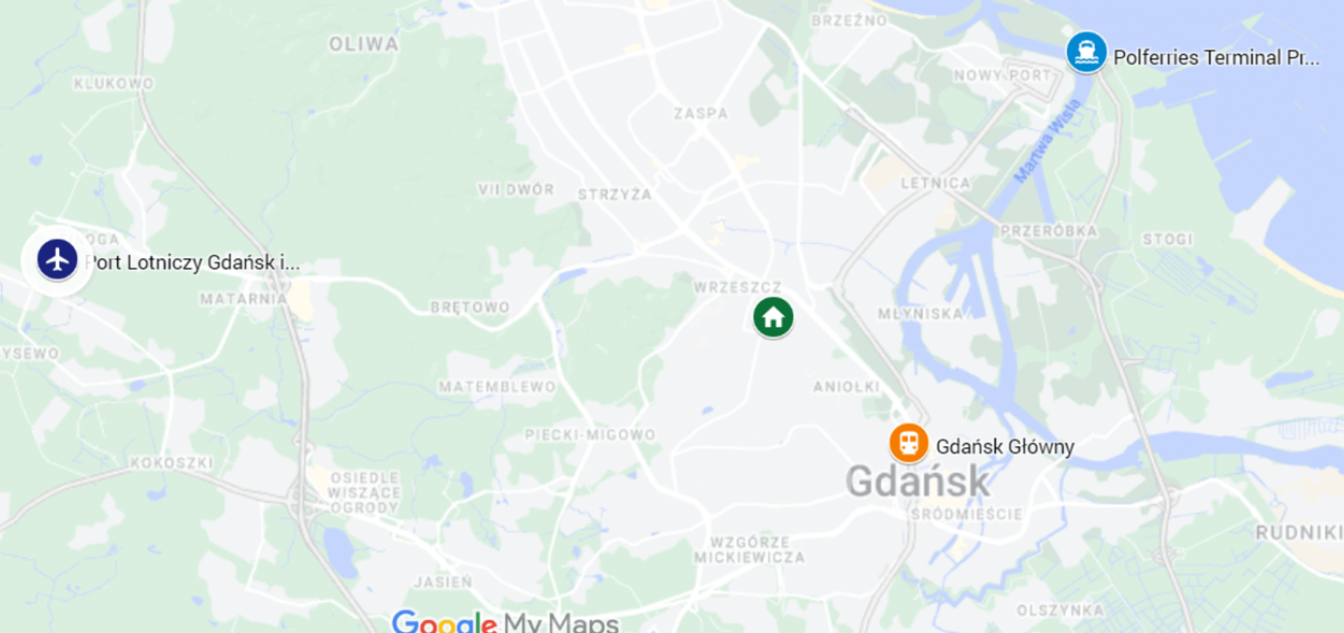
This is a general map of Gdańsk, including the conference venue, i.e. Gdańsk University of Technology, and the places where you will probably start and end your visit to Gdańsk: the airport, the main railway station, and the ferry terminal.
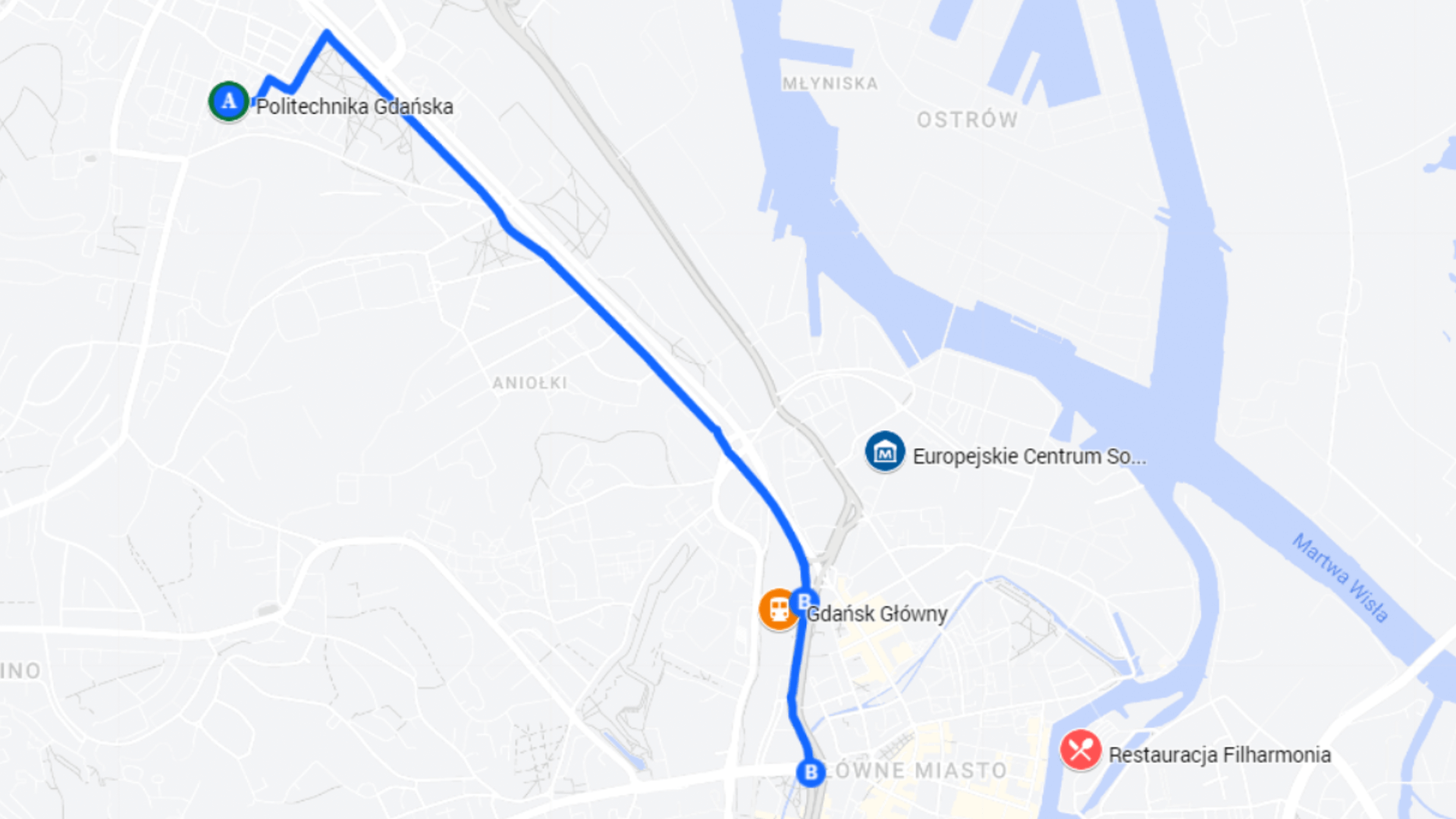
The following map is more detailed. It presents the main conference locations – Gdańsk University of Technology, European Solidarity Centre, Filharmonia Restaurant, and the outline of tram connections between University and the remaining ones.
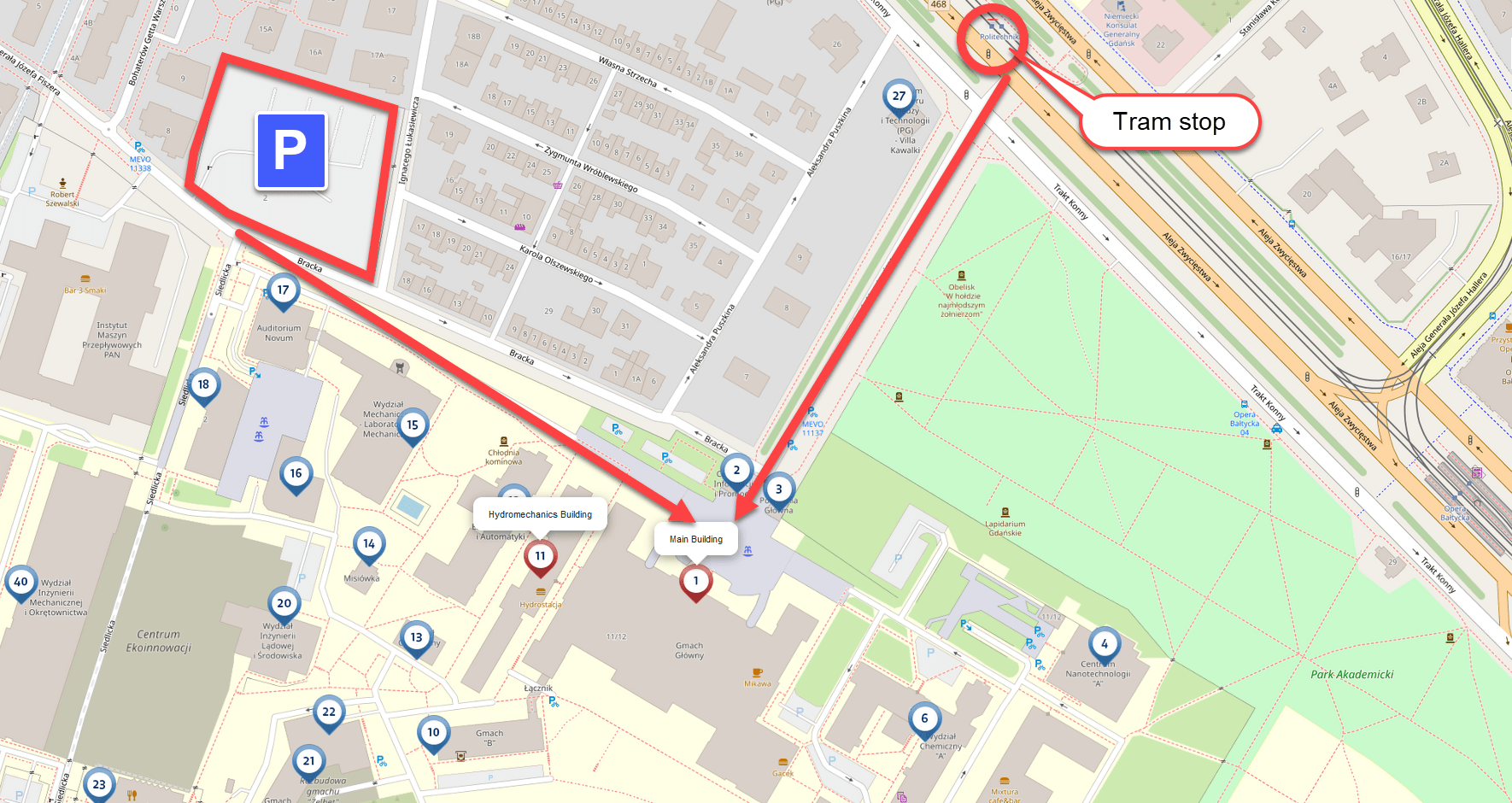
You can reach the Main Building of the Gdańsk University of Technology on foot (about 300 m / 1000 feet) from the car parking lot at ul. Generała Józefa Fiszera 2 or from the “Politechnika 01/02” tram stop (lines 2, 5, 6, 9, 11 and 12).
PUBLIC TRANSPORT
Gdańsk (and its neighbouring cities Sopot and Gdynia) has a well-developed public transit system.
Its main axis is the so-called Szybka Kolej Miejska (SKM or Rapid Urban Railway) running South-North and connecting Gdańsk and Gdynia. There are numerous station on its route, and the main hubs are the stations: Gdańsk Główny, Gdańsk Wrzeszcz, Sopot and Gdynia Główna. Another urban railway system is Pomorska Kolej Metropolitalna (PKM or Pomeranian Metropolitan Railway) connecting Gdańsk Wrzeszcz with Lech Wałęsa Airport.
Gdańsk also hosts an extensive network of tram and bus routes. As part of your registration package, you will receive a transit pass for trams and buses in Gdańsk. The pass must be validated directly after entering a tram or bus of your first transit. Attention: the pass won’t be valid for railway trips.
There are websites and apps helping to find connections, estimate travel times, and buy tickets between the start and destination points across all the available transit modes. We can recommend this service: jakdojade, available in English, both as website and a mobile app.
TAXI
- https://hallotaxi.gda.pl/en/homepage
- https://neptuntaxi.pl/en/
- Ride-hailing: Bolt, Uber, Itaxi
BIKE
- https://ebike24.pl
- https://wypozyczalniarowerowgdansk.pl
- https://exploregdansk.info/transportation/mevo-public-bike-system-in-gdansk/
TRAIN
- https://bilety.skm.pkp.pl/en
- https://apps.apple.com/us/developer/pkp-szybka-kolej-miejska-w-tr%C3%B3jmie%C5%9Bcie-sp-z-o-o/id979316268
- https://play.google.com/store/apps/details?id=com.SKM.KomPas
FERRY
- Gdynia – Hel: https://www.zegluga.pl/cruise-gdynia-hel
- Gdańsk – Westerplatte cruise: https://www.zegluga.pl/cruise-gdansk-westerplatte
- Sightseeing the Port of Gdynia: https://www.zegluga.pl/sightseeing-the-port-of-gdynia
- Gdańsk – Sopot: https://www.zegluga.pl/cruise-gdansk-sopot